
Geodesy / Handheld SLAM Scanner for Real Scene 3D Reconstruction
Powered by industry-leading SLAM algorithms, the LS1 combines LiDAR, vision sensors, and integrated RTK capabilities to achieve real-time centimeter-level precision. It features full-scale, real-time color point cloud output and an instant accuracy display, providing professionals with intuitive and highly accurate data insights. Designed for seamless operation in diverse environments, the LS1 automatically adapts to both indoor and outdoor settings without the need for manual configuration, ensuring efficiency and reliability in any application.
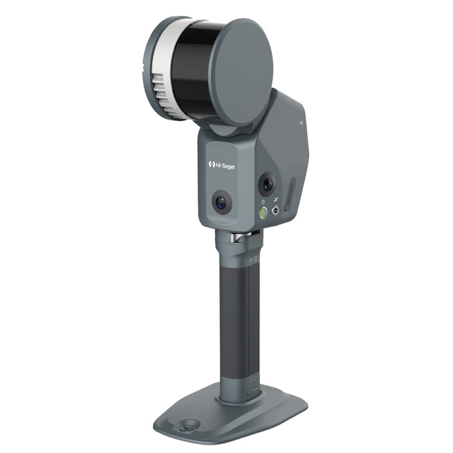
Compact All-in-One Design with Built-in RTK
The LS1 features a fully integrated design with no external antennas or add-ons, offering a sleek and simplified solution. It supports a“1+1”base station mode and direct CORS connection, enabling RTK-SLAM for real-time high-precision georeferenced point clouds. Additionally, the LS1 supports PPK-SLAM processing through its software, empowering users to tackle even the most complex and challenging environments with ease.
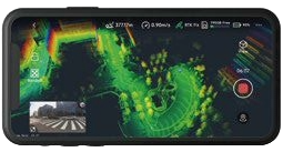
Adaptive Scanning with Real-Time Accuracy Feedback
The LS1 intelligently adapts to diverse scanning environments, eliminating the need for manual mode selection. Capture dynamic scans effortlessly by walking through the job site, while the integrated accuracy heatmap provides real-time feedback on data quality. This visual tool allows users to monitor scan precision and identify areas requiring further attention, ensuring accurate and reliable results for any project.
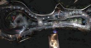
Effortless Scanning for Large-Scale Projects
The LS1 is designed for simple and quick scanning, allowing anyone to operate it with ease. Its real-time scene monitoring ensures accurate tracking of changes, while a 3-hour battery life makes it capable of handling large-scale environments effortlessly. With advanced data fusion from control points and RTK, along with automatic target recognition, the LS1 guarantees high-quality results for any project.
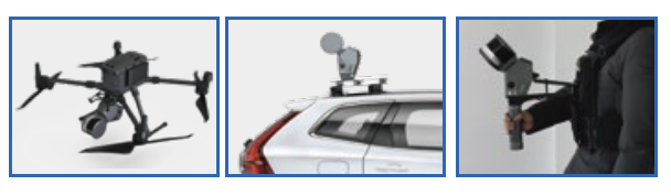
Support Multiple Platform Operation Modes
It enables seamless transitions between handheld, backpack, vehicle-mounted, and airborne operations for diverse surveying needs.
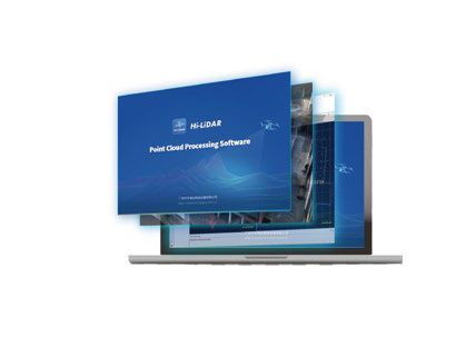
Hi-LiDAR Processing Software(SLAM Function)
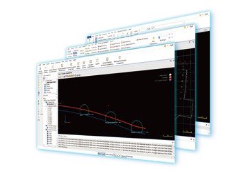
SLAM Wizard Processing
One click process with automatic data filtering, georeferencing and colorization, help you easily to get the best result.
Support Comprehensive Coordinate System
Compatible with global coordinate system, Geoid, re-projecting to get georeferenced and clean data.
Support PPK Processing
Boost data accuracy and reliability with Post-Processing Kinematic (PPK) solutions, ensuring precise dynamic positioning for your projects even in areas without network coverage or signal obstruction.
AEC (Architecture, Engineering and Construction) Module
Architecture
Effortless point cloud slicing and unfolding for seamless CAD geometry assistance.
Engineering & Construction
Extracting precise horizontal and vertical sections to create detailed drawings for engineering analysis and project planning, simplifying the visualization of complex structures for infrastructure, construc- tion, and diagnostics.
APP
PC
| Laser Scanning Parameters | |
|---|---|
| Point Frequency LS1 | 320,000 pts/s |
| Point Frequency LS1 PRO | 40,000 pts/s |
| Measurement Range LS1 | 120 m |
| Measurement Range LS1 PRO | 300 m |
| Field of View | 360° × 270° |
| Measurement Accuracy | <5 cm |
| Relative Accuracy | 1 cm |
| Imaging Parameters | |
| Image Resolution | 2592(H) × 1944(V) |
| Camera Field of View | 135° × 100° |
| Mapping and Processing | |
| Mapping Modes | SLAM, SLAM-RTK, PPK |
| Real-time Processing | Real-time Solution, Real-time Coloring, Accuracy Heatmap |
| GNSS and Positioning | |
| RTK Protocol | Ntrip |
| Supported Satellite Systems | BDS: B1, B2, B3, B1C, B2a, B2b GPS: L1C/A, L1C, L2P(Y), L2C, L5 GLONASS: L1, L2 Galileo: E1, E5a, E5b, E6 QZSS: L1, L2, L5, L6 IRNSS: L5 SBAS: L1, L2, L5 |
| General Parameters | |
| Weight | <1.85 kg (exclude battery and GCP benchmark) |
| Battery Endurance | 180 minutes |
| Battery Capacity | 70.56 Wh |
| Storage Capacity | 1 TB |
| Protection Rating | IP54 |
| Operating Temperature | -20°C to 55°C |
| Storage Temperature | -25°C to 60°C |


Fill out the form with your details and get in touch with us. One of our consultants will be at your disposal to evaluate your needs with you.

V700S integrates advanced RTK and SLAM technologies to deliver centimeter-level accuracy in both open environments and GNSS-denied areas, enabling efficient, reliable surveying anywhere.
Handheld SLAM Scanner
RTK GNSS system with IMU sensor and visual positioning technology
Fill out the form with your details specifying what you need in the request type section. Our team is at your disposal to find the best solution to you needs.

Novatest srl
Via Albertini, 36/F8
Gross Ancona
60131 Ancona (AN) - IT


